We’re all sitting in the Bermuda airport waiting for our flight back to Boston. I think we all could stay a few more days. I’d feel worse about leaving if I wasn’t so excited to head up to Katahdin tomorrow. Yesterday was the warmest yet so I might experience an 80 degree temperature difference over three days. I hope Bermuda hasn’t made me too soft.
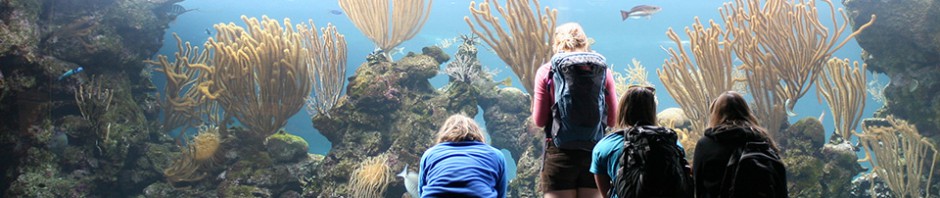
I’m sure I’ll be back to Bermuda someday but I know it won’t be the same without Bruce’s connections. Yesterday’s highlight was going back to the aquarium, this time for a behind the scenes tour. We got to see all of the machinery that makes the aquarium work and the animal rehabilitation room. They had two young orphaned Longtails who were surprisingly docile, sitting on the scale to be weighed and letting us pet them without protest. Apparently they lose weight rapidly if they don’t eat about 1/3 of their body weight per day. To for me that would be eating about 50 pounds of fish per day. The Longtail ate a sardine nearly as long as himself; I was afraid he would choke on but he managed to get it down after a few spastic jerks.
Yesterday we also got to go snorkeling at North Rock, a tiny island about 9 miles north of the mainland. North rock marks the northern edge of the Bermuda platform, the mostly underwater carbonate reef that Bermuda sits on. In past ice ages, when much of the ocean went into forming the glaciers, a much larger area of this reef was exposed above water, making the island of Bermuda many times larger than it currently is. Sea level has also risen in warm periods, resulting in a smaller island that can be observed in the fossil reefs many feet above current sea level. Bermuda, unlike Maine, shows little evidence of isostasy, i.e. change in how high or low the plate floats on the liquid mantel. The Maine coast is still expanding today as the land slowly rebounds from the weight of the glaciers. Bermuda on the other hand is stable, so it is the perfect yardstick for understanding changes in sea level. Seeing that exposed reef was the first time I’ve seen with my own eyes proof of a past higher sea level. Scientists use Bermuda to understand sea level change all the time. Another good way to see it is in caves. Many caves on Bermuda fill with water which stays more or less at sea level. Stalagmites (the ones on the floor) standing under the surface indicate that they formed in a time when the oceans were lower because stalagmites can’t form underwater. We went in one cave with a 25 foot stalagmite fully submerged under water. Ice ages take a lot of water out of the ocean.
In the end I can see why Bruce keeps taking geology trips to Bermuda. Its the perfect place to see and understand geological events without getting into too much esoteric reckoning like absolute dating and taking core samples. We could look anywhere and see the hardened dunes, carbonate shells, and cup reefs that took part in forming the island. In this way Bermuda’s sedimentary geology is much simpler than Maine’s igneous history, allowing me to feel pretty accomplished for a single month course. Thank you Bruce, and everyone else who made it a great trip including my compatriots in course credit. And if your reading this and have the choice to go on this trip in 2015, do it.